Summer 2025 - How Did It Go?
Taking a quick look at how my forecasts for drought, wildfire, and tornadoes performed.
Kyle Brittain
9/20/2025
Drought
My Forecast: "Worsening drought likely across much of western Canada this summer"
How it went down: In general, drought got significantly worse across much of the country. Many areas saw less than half of their summer precipitation. Drought worsened and expanded across parts of BC, central and northern areas of the Prairie provinces, southern Ontario and Quebec, most of Atlantic Canada, and much of the North.
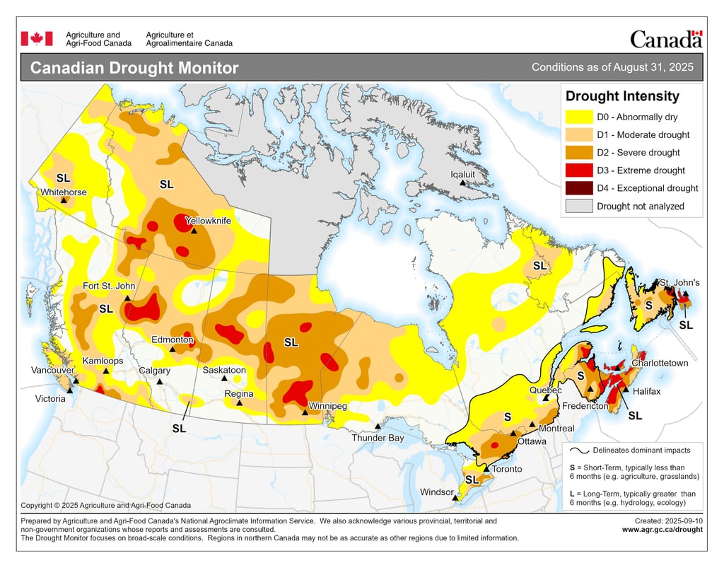
There was one notable exception, though, and that was here at home in southern Alberta. Areas of southeastern British Columbia, southern Alberta, and southwestern Saskatchewan generally saw above normal precipitation this summer – with over 200% of normal rainfall during July in many areas. Following an exceptionally low snowpack in the headwaters of the Saskatchewan River basin, those rains were a literal godsend in staving off water supply problems this summer. With how hot and dry it has been in Alberta since the second week of August, I couldn’t imagine how dire it might have become without those June and July rains.
What’s interesting is that this wet anomaly occurred right in the middle of where long-range forecasts were nearly unanimous in their driest anomalies. A good example of why long-range precipitation forecasts should always be taken with a grain of salt.
Wildfire
My forecast: “It seems more likely than not that this summer will be warmer and drier than average across a large area of western Canada. This means another active wildfire season could be in the cards.”
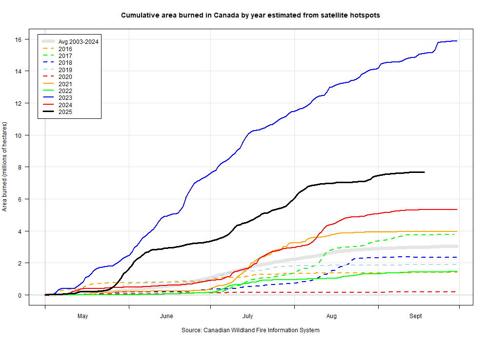
How it went down: 2025’s wildfire season ended up being the second-worst on record in terms of area burned, with just under 9 million hectares consumed. There were periods of action across the country, but the season was by far the worst in northern Saskatchewan and Manitoba, which collectively shared about half of the total area burned.
Again, plentiful rainfall in southeastern British Columbia and southwestern Alberta saved the season there. Otherwise, it could have been bad.
Drought has expanded across much of Canada, as per the August 31 Drought Monitor update. Compare this with the March 31 North American Drought Monitor map, linked above in "my forecast". Credit: Agriculture and Agri-Food Canada.
2025 is in black. 4 of the past 5 years have seen well-above normal area burned in Canada. Credit: Natural Resources Canada.
Tornadoes
My Forecast: “I am forecasting a less active summer than normal in terms of thunderstorms and tornadoes in the Prairies”.
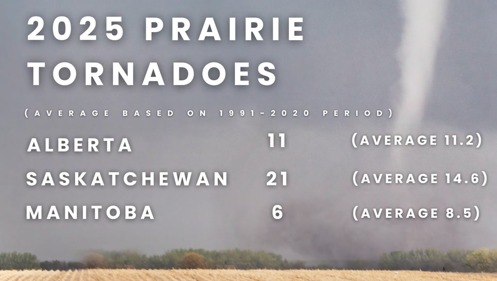
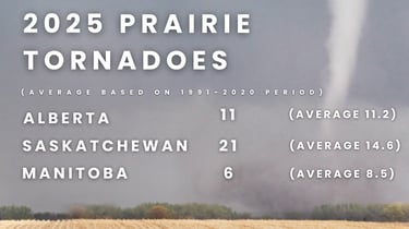
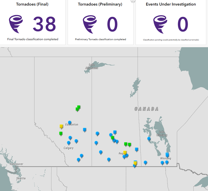
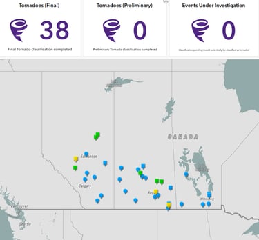
How it went down: Based on the long-term average of 34.3 tornadoes per year across all three Prairie provinces, the 2025 tornado season was slightly above average, with 38 confirmed in total.
From a storm chasing perspective, however, there were very few notable (photogenic and/or significant) events this year - much unlike the US. Moreover, the detection of Canadian tornadoes has markedly improved since the Northern Tornadoes Project began doing their work in 2017. It is likely that future tornado climatology periods will eventually reflect this reality, assuming a similar, favourable climate for tornado events continues. Thus, the 1991-2020 climate period has yet to reflect most of this work.
Besides the Northern Tornadoes Project (and techniques such as high-resolution surveillance with satellites and drones), there are other obvious factors for why tornado reports have increased. These include the sudden increase in members of the public having access to camera phones and social media, a growing population, and increased numbers of skilled storm spotters. The latter is especially important for racking up the numbers with ephemeral, EF0 spin-ups.