When Hail Scars the Earth - 12 Examples of Satellite-detected Hail Swaths in Alberta
Kyle Brittain
8/25/20255 min read
The severe thunderstorm of August 20 in southern Alberta packed large hail and destructive winds that damaged cars, homes, and even took out a length of transmission towers near Brooks. Copious amounts of hail driven by wind gusts clocked as high as 149 km/h flattened crops and grasslands along hundreds of kilometres of the storm's track. For agricultural producers preparing to harvest crops within its path, it was the dreaded "Great White Combine".
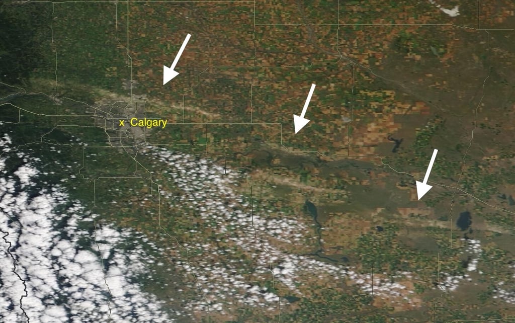
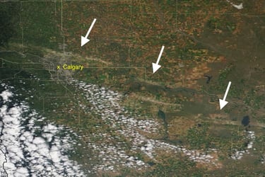
In a year of abundant plant growth owing to above average summer rainfall, the scar left behind by the hail swath is easily visible from space.

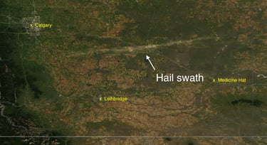
MODIS satellite imagery of the hail swath across southern Alberta as seen on August 24, 2025. Credit: NASA.
Hail is by far the costliest thunderstorm hazard, causing millions to billions in losses across Canada each year - and can be destructive in many ways. Hail larger than about 3 cm can begin to do body work to your car and punch holes in vinyl siding, with increasing impacts the larger it gets. But small hail can also be destructive - especially when being driven by the wind.
Wind increases the impact force of hail, no matter its size - but it also enables it to cause damage from above and from the side. This is why wind-driven hail has a particular knack for mowing down crops, where a wall of sideways marbles would always be considered worse than a few sparse baseballs falling straight down.

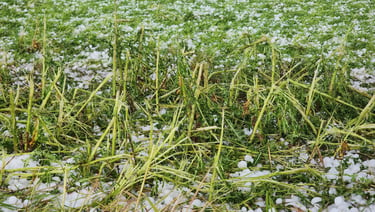
Flattened crops near Del Bonita, Alberta on July 27.
The availability of high resolution imagery from polar-orbiting satellites affords us the opportunity to see the impacts of hailstorms over cropland on clear days. It turns out that the storm of August 20 is reminiscent of other major wind-driven hail events that have occurred in recent years - a defining feature of one of the most hail-prone regions in the world.
NASA Worldview has consistent MODIS satellite imagery going back to 2001, and has several impressive examples of hail swaths over southern and central Alberta. Let's look at 11 other remarkable examples:
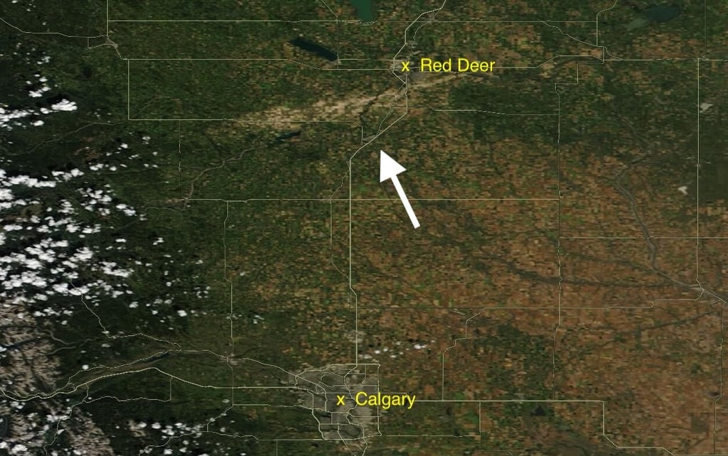
August 10, 2006
Image from August 18, 2006 of a significant hail swath just south of Red Deer. Credit: NASA.
July 24, 2007
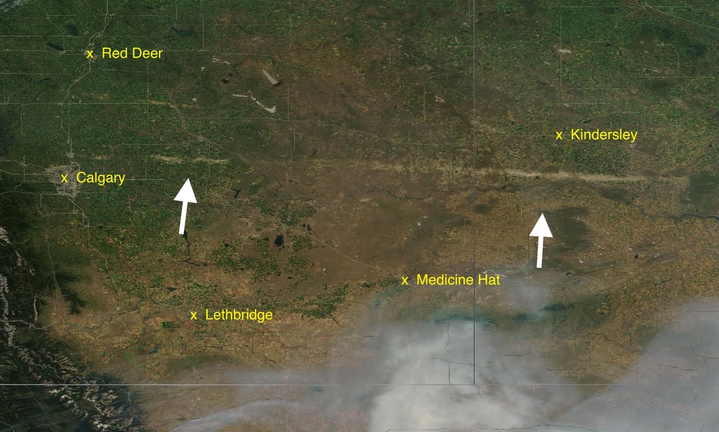

Image from July 29, 2007, showing the longest hail swath in this set of images, at roughly 420 km - spanning from near Calgary to well into Saskatchewan. A second swath can be seen southeast of Red Deer, which occurred on July 15. Credit: NASA.
The storm of August 20 was similar to other storms that have caused lengthy hail swaths, such as that of July 24, 2007. A key feature of these storms tends to be their fast storm motions, as they ride along in a speedy jet stream. This causes storms to "feel" stronger inflow winds that balance their otherwise aggressive, icy outflow winds - enabling them to persist for a long time, with maximum impacts.
July 15, 2008
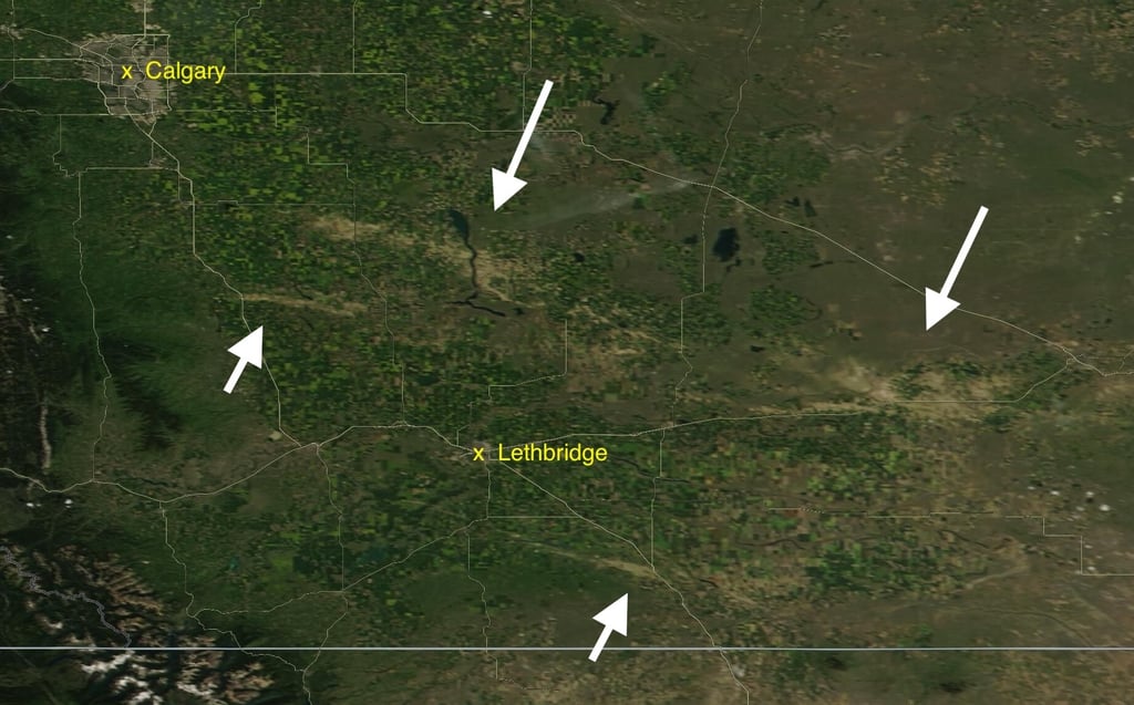

Image from July 20, 2008, showing a pair of swaths from the July 15 storm. The southernmost swath south of Lethbridge occurred the next night, on July 16. Credit: NASA.
August 3, 2009
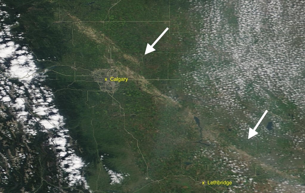
Image from August 8, 2009 of the storm that occurred at an unusual time, in the early morning hours of August 3. This swath was just over 300km. Credit: NASA.
August 12, 2012
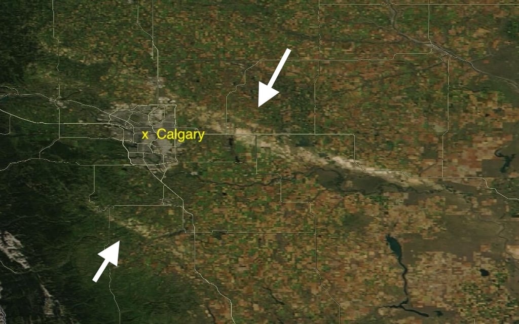
Image from August 18, 2012 of the storm that occurred late in the evening on August 12. This was the second time in four years that the area between Calgary and Strathmore suffered significant crop damage due to hail. The southern swath occurred on the afternoon of August 14. Credit NASA.
July 6, 2013
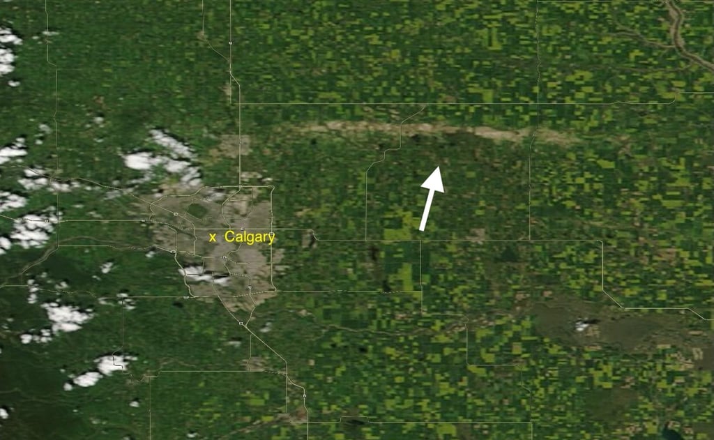
Image from July 10, 2013. Credit NASA.
August 7, 2014
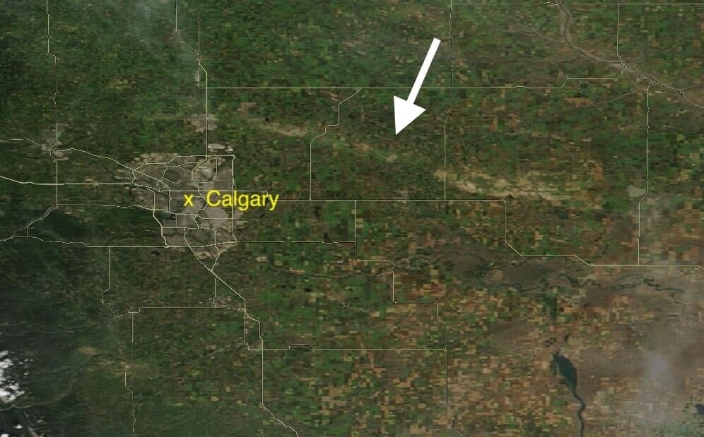
Image from August 10, 2014. There were three separate hailstorms in this region on August 7, 2014. Credit: NASA.
July 30, 2016
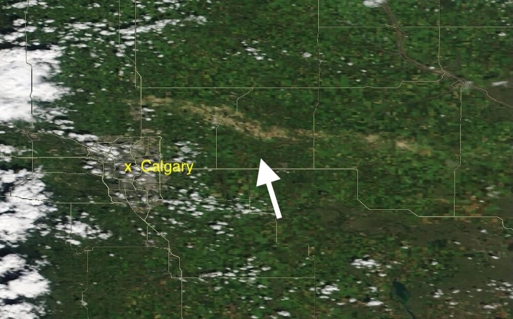

Image from August 4, 2016. The third such occurrence in 4 years for areas from near Irricana to north of Strathmore, revealing the very hail prone area to the immediate north and east of Calgary. Credit: NASA.
August 6, 2019
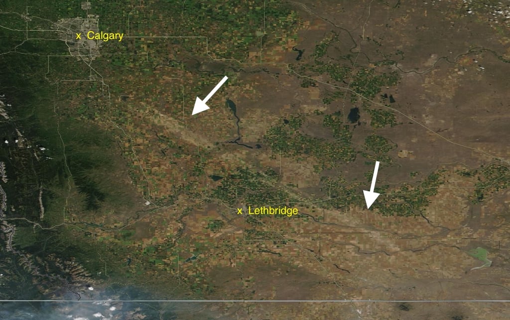
Image from August 8, 2019. The hail swath was about 230km long and did a number on that year's Taber Corn crop. Credit: NASA.
July 18, 2022
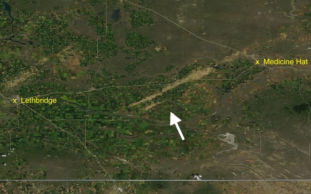
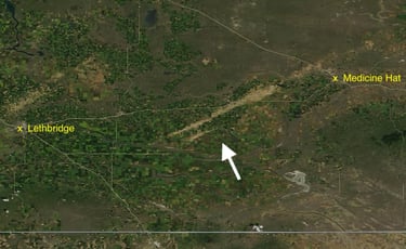
Image from July 24 showing a pair of swaths southwest of Medicine Hat, which occurred early in the afternoon of July 18. Credit: NASA.
That we can see hail scars from space is impressive, with these "true colour" satellite images showing us essentially what our eyes would naturally see. But other imagery, such as "false colour" or NDVI (normalized difference vegetation index) can also be used to assess the density and health of vegetation, based on the amount of near-infrared radiation that leafy matter reflects.
High resolution imagery from Sentinel-2 L2A of the July 18, 2022 storm southwest of Medicine Hat clearly shows the highly-localized impacts of the hail over irrigated farmland:

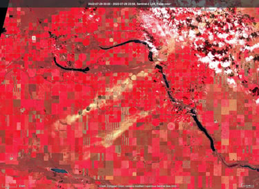
A false-colour image from Sentinel-2 L2A on July 29, 2022, where hail swaths appear as pale yellow and orange, compared with the healthier surrounding vegetation that appears as red. Credit: Copernicus.


NDVI imagery from July 29, 2022, where hail swaths appear lighter shades of green, compared with surrounding vegetation. Dark green are irrigated crops, with thick, healthy vegetation. Credit: Copernicus.
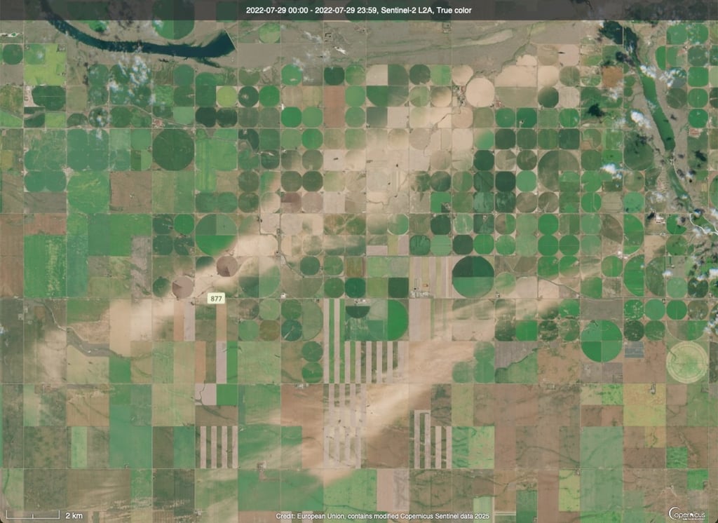
For reference, here is a zoomed-in image of the affected area as seen in true colour. Note the extremely localized impacts - even right down to half the circle of fields with a centre-pivot irrigation system. Credit: Copernicus.
August 5, 2024
