Pyrocumulonimbus outbreak in Alberta
A series of firestorms raged across northern Alberta on the evening of 29 May.
Kyle Brittain
5/31/20254 min read
An outbreak of pyrocumulonimbus clouds occurred across northern Alberta on the evening of Thursday, 29 May 2025.
Pyrocumulonimbus clouds, or “pyroCbs” (as we call them in the weather world), are fire-generated thunderstorms. These colossal fire clouds are big enough to influence the weather around them and be associated with lightning, gusty winds, black rain and hail, and even tornadoes. They can grow so tall that they inject smoke into the stratosphere, where it can remain for months as it circulates around the globe.
They tend to occur when a special set of ingredients come together:
Abundant, dry vegetation that serves as fire fuel
Hot, dry, and windy weather that drives intense wildfire behaviour
An unstable atmosphere that enables tall cloud development
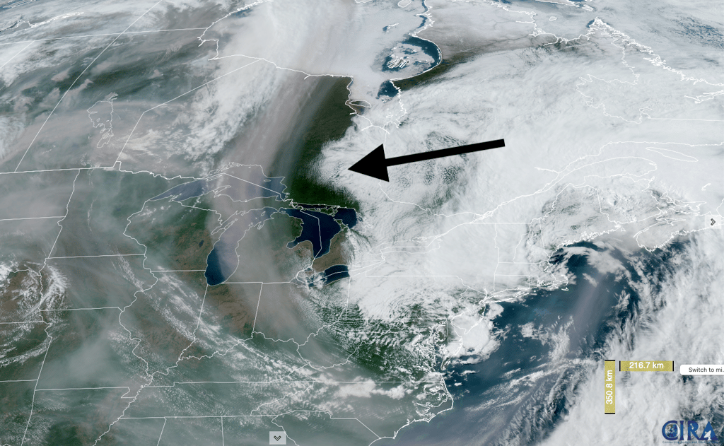
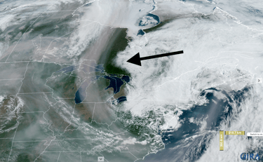
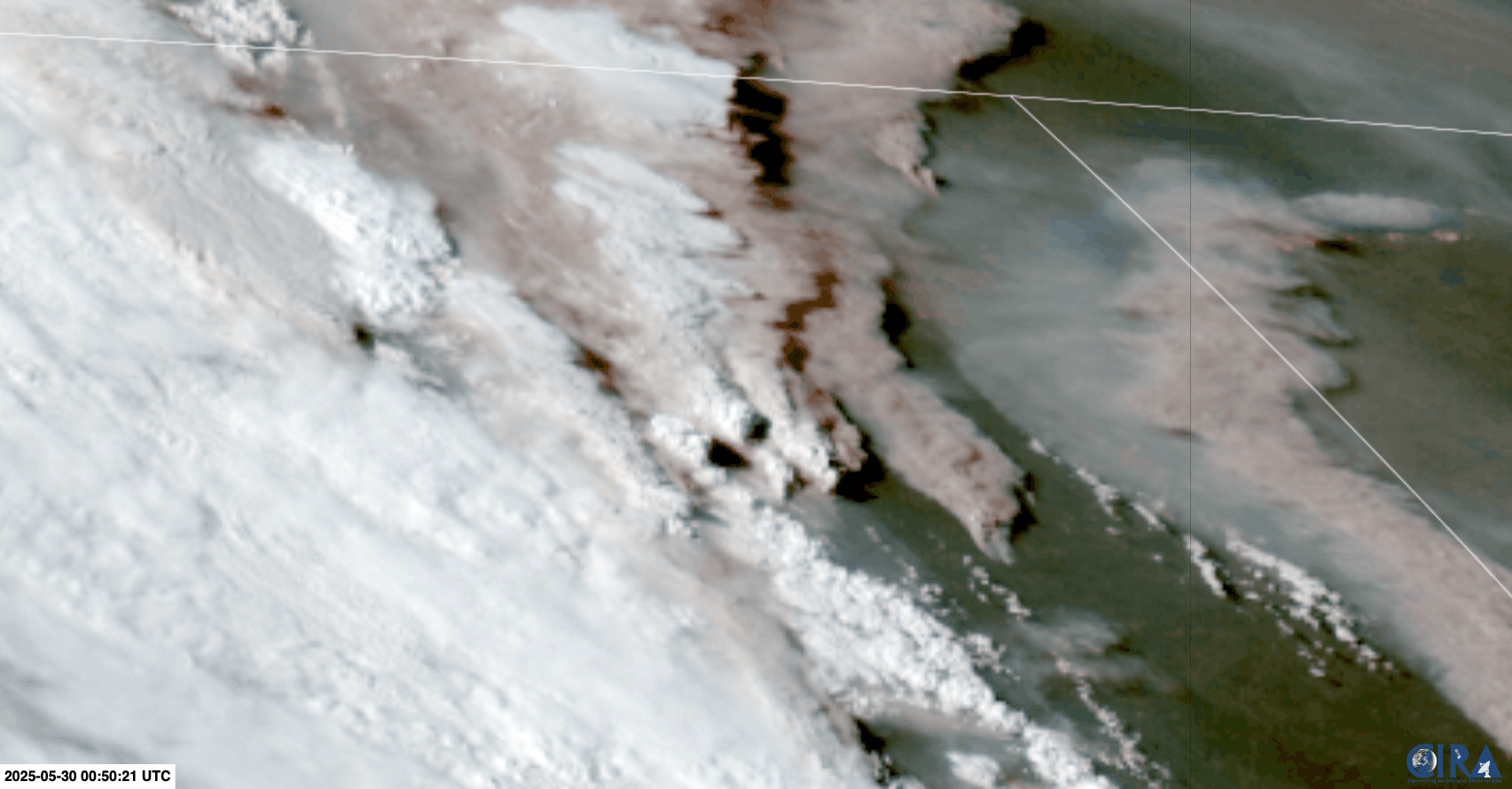
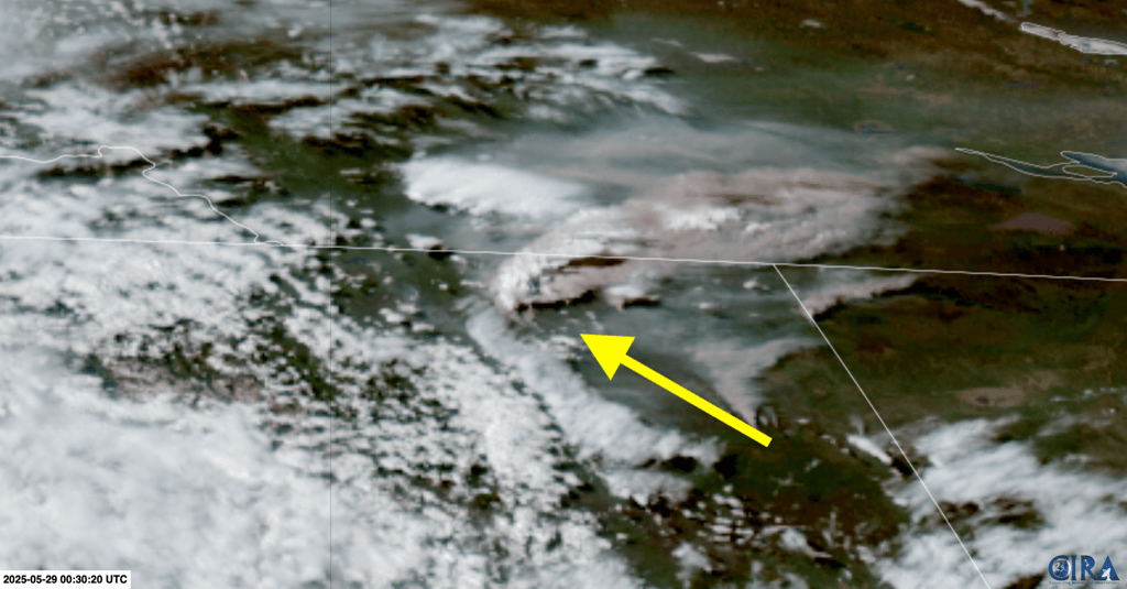
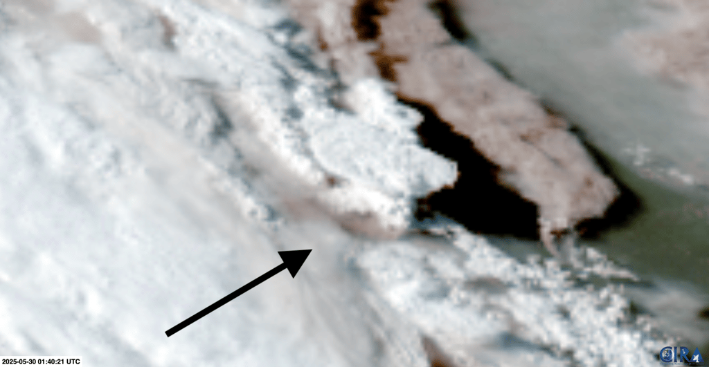
Satellite image of northern Alberta on the evening of 29 May 2025. Smoke appears as brown, and condensed cloud as white. Note the vigorous convective cloud development near the center of the image. Credit: CIRA.
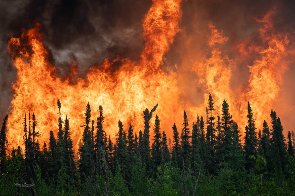
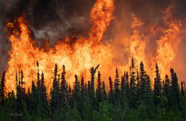
Intense crown fire activity (in the upper canopy of the forest) can generate the energy required to trigger a pyrocumulonimbus. This image was shot on a fire east of Utikuma Lake on the afternoon of 29 May.
In order for a fire-generated cloud to attain pyroCb status, it needs to rise high enough into the atmosphere that condensed water droplets freeze, which tends to happen below about -38°C. We can also call it a pyroCb if it produces lightning, which means the cloud has grown tall enough to cause ample charge separation for lightning discharges.
PyroCbs used to be a rare occurrence in Canada, but we have been seeing more of them in recent years – especially in 2021 and 2023. This year, we’ve already had a handful, including in northeastern British Columbia on 28 May. Here, a pyroCb was driven by a wildfire that made a 60 kilometre run in one night.
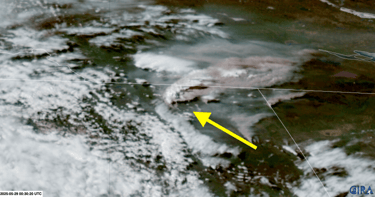
A pyrocumulonimbus cloud erupts in northeastern British Columbia on the evening of 28 May. This is likely part of a third-year fire that ignited in 2023. Credit: CIRA.
On the evening of 29 May, I counted at least 8 pyroCb events on satellite imagery across northern Alberta. Most were brief, triggered by the passage of a strong cold front that fanned the flames of numerous wildfires, producing a momentary burst of ferocious fire behaviour. Several produced lightning flashes.
The most intense pyroCb happened atop a wildfire burning near Chipewyan Lake, which was the only one that developed well before the cold front hit. I was documenting it from Wabasca in the late afternoon, 125 kilometres to the south.

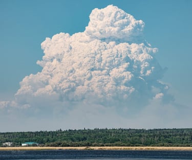
An enormous pyroCb looms over the northern horizon, as seen from Wabasca, a couple of hours before the cold front hit.
Shortly after the cold front arrived at the wildfires near Chipewyan Lake, a new pyroCb exploded high into the atmosphere, producing prolific lightning.
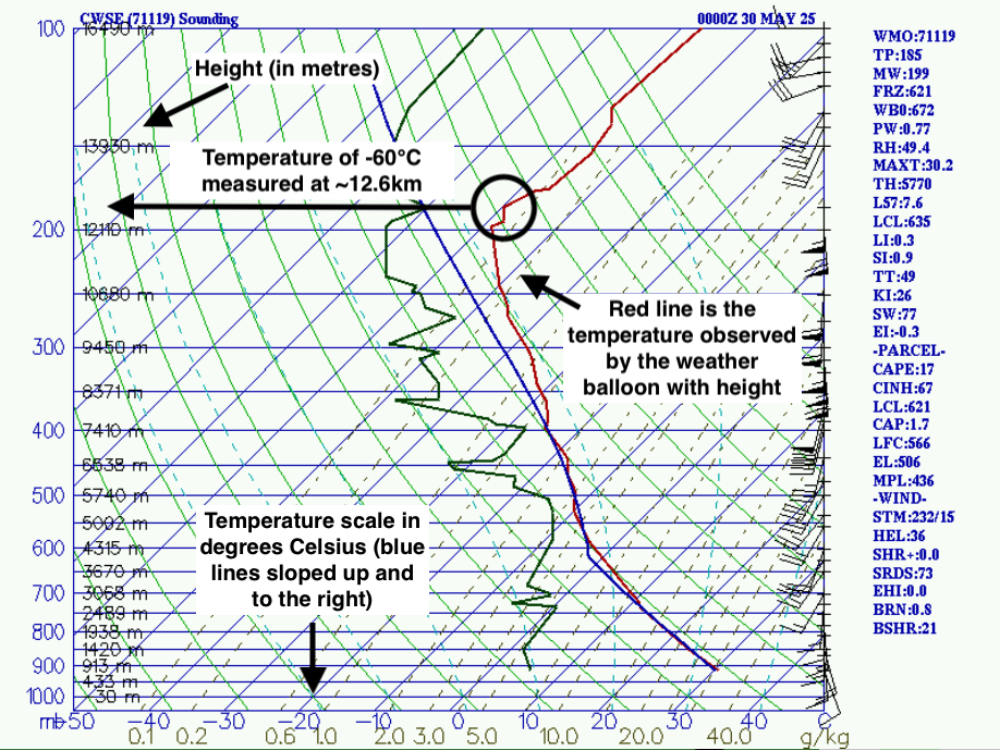
We can estimate the height of these clouds by comparing satellite-indicated cloud top temperature with the observed temperature profile, as measured by a nearby weather balloons. In the case of the Chipewyan Lake pyroCb, infrared satellite imagery estimates cloud tops reached temperatures below -60°C just after 7:30PM. Meanwhile, a weather balloon launched upstream near Edmonton revealed temperatures near -60°C at heights of over 12 kilometres in the atmosphere.
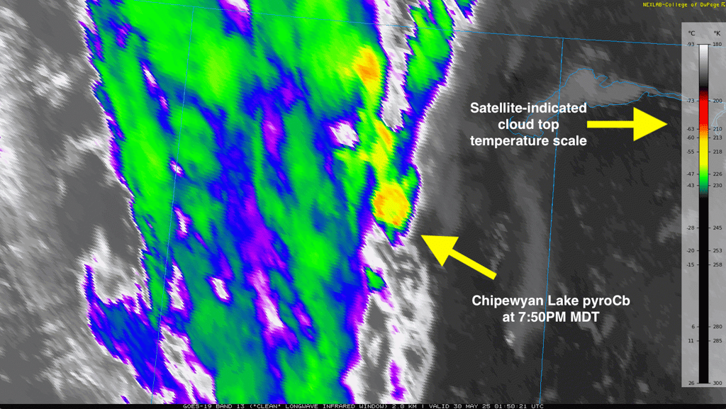
Infrared satellite image of Northern Alberta at 7:50PM MDT, 29 May. Credit: COD Meteorology.
An observation of the temperature, humidity, and winds with height in the atmosphere, as measured by a balloon launched west of Edmonton near 6:00PM MDT. Here, the data is plotted on a skew-T diagram. Credit: COD Meteorology.
This means the Chipewyan Lake pyroCb, with its classic severe thunderstorm appearance, likely reached almost 13 kilometres tall.

A zoomed-in shot of the Chipewyan Lake pyroCb at center, with a vertically-erect updraft tower, overshooting top, and spreading anvil. Time of the image is 7:40PM MDT on 29 May. Credit: CIRA.
It is pretty incredible to think that only 4 days earlier in the same location, there wasn’t even a wildfire on the landscape. A rash of lightning strikes on Monday evening went on to trigger several wildfires in north-central Alberta, which rapidly ballooned in size over subsequent days in the hot, dry, and windy weather. By Thursday night, a firestorm was there, producing its own lightning.
The pall of smoke generated by the firestorms of 28-29 May in northern British Columbia and Alberta got caught up in a fast-moving jet stream, and tracked northeastward. After darkening skies over parts of the Canadian Arctic, the concentrated smoke plume had turned back south and reached as far as the Atlantic coast in North Carolina by the afternoon of 31 May.